- 2025-11-18
- Technical
- By Pyxis Communication
AI Won’t Save the World… Unless We Train It To
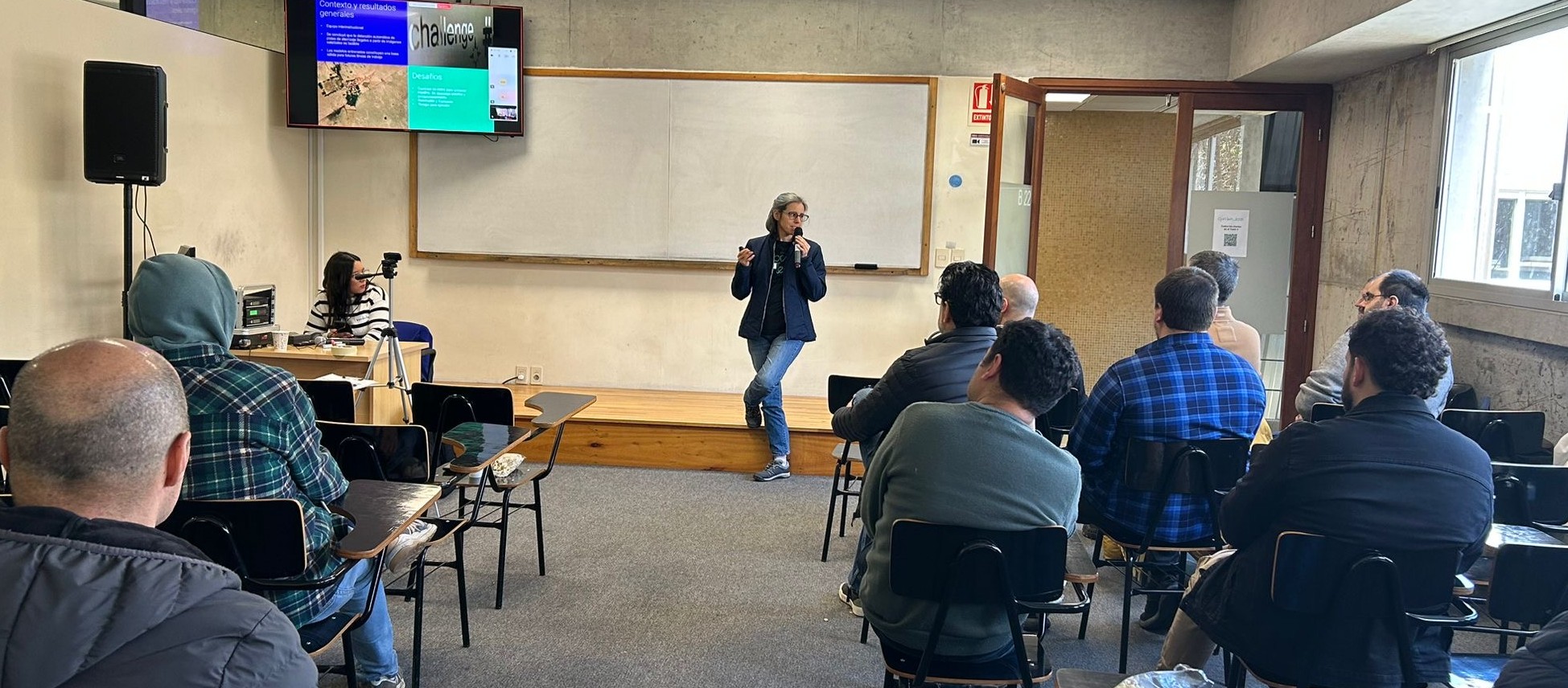
Talk presented by Mariana Silvera (experienced IT manager driving technology for environmental and social impact at Pyxis) – at Open Tech 2025, held on Saturday, September 6, 2025.
Summary
Artificial intelligence can be a powerful tool for addressing environmental, social, and security challenges. But none of that happens “by magic”—it requires engineering, data, and teams committed to solving real problems.
In this Open Tech 2025 talk, Mariana Silvera explored how Pyxis applies AI and Computer Vision to fight illegal fishing, detect contaminants, improve access to education, and even identify clandestine airstrips linked to organized crime. A honest, technical, and human look at how technology—when used with intention—can transform communities.
A talk that begins with an uncomfortable question: Is AI going to save the world?
The short answer: no.
The full answer: no… unless we train it to.
That’s how Mariana Silvera opened her presentation at Open Tech 2025, reminding us that technology is neither a savior nor a villain. What makes the difference is how we use it—and why.
At Pyxis, that “why” has a name: Pyxis Sostenible—an institutional strategy that places the planet and people at the center, guiding initiatives with economic, social, and environmental impact.
Her talk was a journey through projects that combine engineering, data science, and social commitment. And yes: there was humor, there were stories from the field, but above all there was evidence that technology can be a real ally when directed where it matters.
Pyxis Sostenible: technology with triple impact
Before diving into the projects, Mariana set the stage: Pyxis Sostenible is not a standalone area—it’s a cross-company vision.
Since 2009, Pyxis has worked to:
- measure and reduce its carbon footprint,
- support conservation initiatives,
- collaborate with educational organizations,
- and develop tech applications with social and environmental impact.
As Mariana put it:
“Sustainability is not an accessory—it’s the axis that shapes how we think about our business model.”
And that vision becomes concrete through projects—some internationally recognized, others quieter but equally transformative:
-illegal fishing detection
-air quality monitoring
– inclusive education
– and a Computer Vision pilot to identify clandestine airstrips
This last one became the star of the talk—and for good reason.
From oceans to air: how AI helps protect the environment
Before diving into planes and organized crime, Mariana walked through two flagship projects.
1. Proteo: AI against illegal fishing
Proteo was born in 2022 with ANII support to assist NGOs focused on marine conservation.
The challenge:
- Can we detect if a vessel is fishing?
- Can we know if it’s inside a restricted area?
- Can we identify suspicious behavior?
With AIS data—satellite signals broadcasting ship identity and position—and 900 million historical reports, Pyxis trained Random Forest models capable of:
- classifying fishing activity,
- detecting anomalies,
- generating real-time alerts.
The model reached 90% accuracy, enough to support early warnings for authorities and conservation groups.
And yes—ships “talk” without meaning to. We just needed to learn how to listen.
2. Air quality: measuring the invisible
From the ocean, we moved to the air.
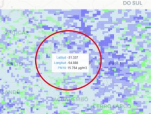
With support from ANII and the Ministry of Environment, Pyxis built models to estimate NO₂, SO₂, and PM10 levels across Uruguay.
The problem:
- Only 10 ground stations exist in the entire country.
- Satellite data measures pollutants—but in the atmosphere, not at the surface.
The solution:
- combine satellite imagery,
- ground measurements,
- and meteorological variables
to train models that estimate surface-level pollutants.
The result:
high-resolution, interactive air-quality maps.
As Mariana said:
“If we can’t measure it from the ground… we measure it from space.”
The standout project: detecting clandestine airstrips with AI
Now for the project that captivated the room.
Can we detect illegal airstrips in Uruguay using Computer Vision?
At first glance, the answer seemed to be: no.
Uruguay is a massive plain—distinguishing a clandestine strip from a dirt road is incredibly challenging.
As Mariana joked:
“At first, even humans couldn’t see the airstrips. So how were we supposed to expect a model to do it?”
And yet: the story took a very different turn.
A project that began with doubts… and proved it was possible
The challenge began with an invitation from the British Embassy and an inter-institutional team:
- Uruguayan Air Force (the real owners of the problem)
- Universidad Católica
- School of Engineering (UdelaR)
- UTEC
- Pyxis
There was:
- no large labeled dataset,
- no clean imagery,
- no guarantee of success.
But there was one question:
Is it worth trying?
Spoiler: yes.
The first challenge: building a dataset almost from scratch
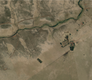
The Air Force provided:
- geographic coordinates of known airstrips (legal + illegal),
- negative coordinates (non-airstrip areas).
Pyxis needed to turn that into usable training images for YOLO models.
The pipeline was an adventure:
- Transform KML coordinates to GeoJSON
- Define 1 km x 1 km crops
- Download satellite images (Planet + Sentinel)
- Discard cloudy or misaligned photos
- Convert geographic coordinates to pixel grids
- Manually annotate bounding boxes
Even then, the dataset was small.
And organized crime rarely leaves tidy, well-photographed examples behind.
Creative engineering: how to compensate for missing data
Two key strategies made the model possible:
1. Transfer learning with a generic dataset
Using a large, generic satellite-imagery dataset—including the “airport” category—validated that transfer learning worked and significantly improved model performance.
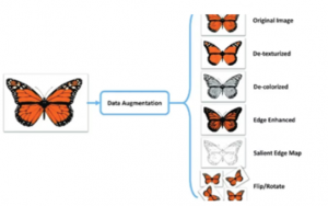
2. Data augmentation
To multiply available samples:
- rotation
- color shifts
- contrast changes
- geometric transformations
- random crops
Pyxis trained YOLO Nano and YOLO Medium versions using GPU instances on Amazon SageMaker.
The results?
Surprisingly strong.
Does the model work? Yes—and better than expected
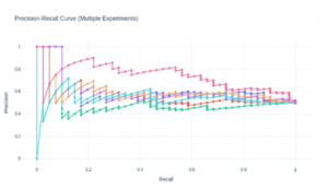
Performance was evaluated through:
– Precision
Of everything the model said was an airstrip—how much was correct?
– Recall
Of all airstrips that exist—how many did it find?
The Air Force prioritized recall, accepting more false positives because humans would review the results.
Key findings:
- Pretrained models outperformed those trained from scratch.
- YOLO Nano beat YOLO Medium (less overfitting with small datasets).
- Planet imagery outperformed Sentinel (higher resolution).
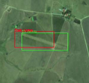
The final model detected airstrips with remarkable accuracy—sometimes spotting runways humans took a while to see.
As Mariana joked:
“Some of the false positives weren’t so false.
Sometimes the model saw the runway before we did.”
From theory to practice: a model ready for real use
Pyxis delivered to the Air Force:
- a Docker container,
- the final trained model,
- an inference interface for new images.
The outcome:
- a reproducible pipeline,
- an operational model,
- a deployable analysis tool.
The Air Force is already testing it.
If validated, a Phase 2 could expand funding and geographic coverage.
This is just the beginning.
Why this matters: Uruguay is a hotspot for organized crime
Because of its geography and coastline, Uruguay is increasingly attractive for clandestine flights. Detecting improvised or camouflaged airstrips helps:
- anticipate illicit operations,
- improve patrol strategies,
- support regional intelligence efforts.
This pilot could scale to Paraguay, Bolivia, or Brazil—where topography (forests, mountains) would actually make detection easier.
If it worked in Uruguay’s flat plains… it will work even better in the jungle.
Final reflection: AI does not do good by default
Mariana closed with a message that resonated:
“Technology doesn’t change the world on its own. People who choose how to use it do.”
AI doesn’t save ecosystems.
It doesn’t stop crime.
It doesn’t improve education.
But when trained well, designed carefully, and aimed at meaningful problems—it can do all that.
And that’s where organizations like Pyxis come in.
The role of Pyxis: engineering with purpose
These projects are not just technical experiments—they’re expressions of a philosophy:
- using AI for good,
- measuring impact,
- collaborating with public institutions,
- applying science rigorously,
- building capabilities that outlast individual teams.
Pyxis doesn’t just build models—it builds:
- trust,
- partnerships,
- capacities,
- and pathways for technology to improve real communities.
As Mariana concluded:
“We bet on the world changing—and we want to help shape that change.”
Tags
AI engineeringAI for goodair quality monitoringAIS dataartificial intelligenceclandestine airstripscomputer visioncontaminant detectioncrime prevention technologydata augmentationenvironmental AIenvironmental monitoringgeospatial AIillegal fishing detectionMachine LearningNO2Open Tech 2025PM10PyxisPyxis SostenibleRandom Forestresponsible AIsatellite imagerySO2social impact technologySustainabilitysustainable technologytransfer learninguruguayYOLO model

With a 360° potential, our solutions matrix accompanies the lifecycle of any project, with skills and experience in Development, Design, Q&A, Devops, Operation & Deploy, and Architecture
Discover all post